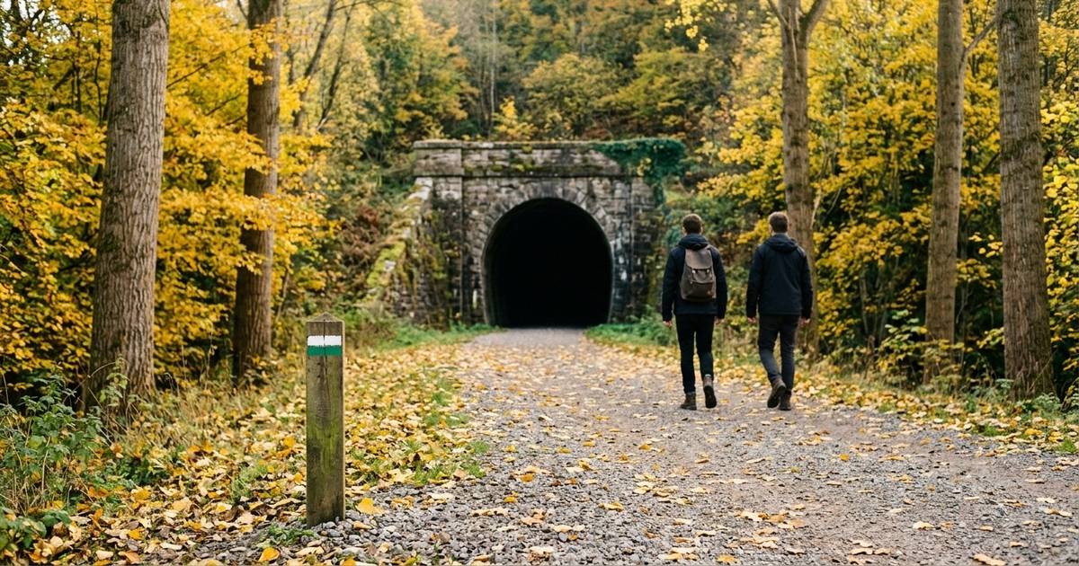
There are far more than you’d think, and they’re one search away. If you live in Spain or you’re visiting, the greenways, the waymarked trails approved by the mountain sports federation and the free maps from the National Geographic Institute cover almost the whole country — and none of them asks you to sign up or pay.
The problem is hardly ever a lack of routes. It’s that at ten o’clock on a Sunday morning you don’t know where to look, and you end up doing the same loop round the park as always. Which is fine, mind you — but there’s life beyond it.
Greenways: where the train used to run
It’s the best way in there is, and lots of people don’t even know they exist. Spain’s vías verdes, or greenways, are old railway lines that lost their trains and have been turned into paths for walking or cycling. According to the Spanish Railways Foundation, which has run the programme since 1993, there are more than 3,600 kilometres across 143 routes.
And they have an advantage no other path has: because a train used to run there, the slopes are gentle. Trains never got on well with hills, so anyone walking their old lines today inherits that good taste. Tunnels, bridges and the odd old station thrown in.
Their website has a map to see which one is near you. There’s a good chance you’ve got one less than an hour away and don’t know it.
Waymarked trails, and how to read their marks
The Spanish Federation of Mountain Sports and Climbing approves trails all over the country, and it has a trail finder where you enter a town or region and it shows you what’s there. The site is in Spanish, but searching by town is easy. One honest warning: it only lists the trails the regional federations have sent in, so some may be missing. If nothing comes up nearby, it doesn’t mean there’s nothing — ask at the local tourist office.
Once you’re on the trail, the marks painted on rocks and posts always come in two stripes: a white one on top and a coloured one below. The colour tells you what’s ahead:
White and green: local trail (SL). Under 10 kilometres. This is the one for you if you’re starting out, and it’s exactly the ‘short waymarked route’ we talked about in gentle hiking.
White and yellow: short-distance trail (PR). Between 10 and 50 kilometres. For when the green one starts to feel too short.
White and red: long-distance trail (GR). More than 50 kilometres, usually over several days. If you come across one, you don’t have to finish it: you can walk a stretch and turn back — nobody’s counting.
And if you see the two stripes crossed in an X, it means not this way. That’s the one that saves the most trouble.
The official map, free and in your pocket
Spain’s National Geographic Institute has an app called Mapas de España. It’s free, it’s available in English, it uses the Institute’s own mapping and it includes the routes in the National Parks and the stages of the Camino de Santiago.
But what really matters is something else: you can save the maps before you set off and use them offline. Out in the countryside, the signal vanishes exactly at the junction where you’re unsure, as if by some unwritten law. Download the area at home, on the wifi, and save yourself the moment of staring at your phone with a poker face.
Did you know? As well as the greenways, Spain’s Ministry of Agriculture has its own network of Caminos Naturales (‘natural paths’), and some of them are old railway lines too. If a path carries both names at once, you’re not lost: it just happens to be both.
And what’s even closer to home
Many town and provincial councils have their own local routes, sometimes not officially approved, published on their websites or in a leaflet at the tourist office. They’re the ones that show up least online and the ones that tend to be closest.
And to get started, you don’t even need a named route. Twenty minutes in the nearest bit of green already counts, and it’s the best training for making sure your Sunday walk doesn’t catch you cold.
Before you set off: two autumn things
Check what time the sun sets. In October it gets dark a lot earlier than your body still thinks, and what was a gentle stroll in August can end with your phone torch. Set off in the morning and you’ll have plenty of time.
Tell someone where you’re going. Not because anything will happen, but because it’s free and it lets you walk with peace of mind. Water, some fruit, and you’re done. And if the weather turns, we’ve already covered what to do on rainy days.
Start today: open the trail finder, enter your town and look for a white-and-green one. That’s your Sunday sorted.
Frequently asked questions
Where can I find walking routes in Spain?
In three free places, with no sign-up: the trail finder of the Spanish Federation of Mountain Sports and Climbing, which searches by town or region; the map of greenways (vías verdes) from the Spanish Railways Foundation; and the Mapas de España app from the National Geographic Institute.
What do the colours of the trail marks mean?
There are always two stripes, a white one on top and a coloured one below. White and green is a local trail, under 10 kilometres. White and yellow is a short-distance trail, from 10 to 50 kilometres. White and red is a long-distance trail, over 50 kilometres and usually several days long.
What is a vía verde?
A greenway: an old, disused railway line turned into a path for walking or cycling. Spain has more than 3,600 kilometres of them across 143 routes. Because a train used to run there, the slopes are gentle, which makes them one of the best options for beginners.
Is there a free map app for walking in Spain?
Yes: Mapas de España, from the National Geographic Institute. It’s free, available in English, uses the official mapping and lets you save maps before you set off to use them offline, which is exactly what you need in the hills.
Which route should I choose if I’ve never been hiking?
A local trail, the one with white and green marks, or a stretch of greenway. Short, circular if possible, and in the morning. What matters isn’t the distance: it’s coming back wanting to do it again.